It will be a magical start to December if �鶹��ýӳ��city receives its first dusting of snow for the season, with a chance of flurries in the weather forecast.
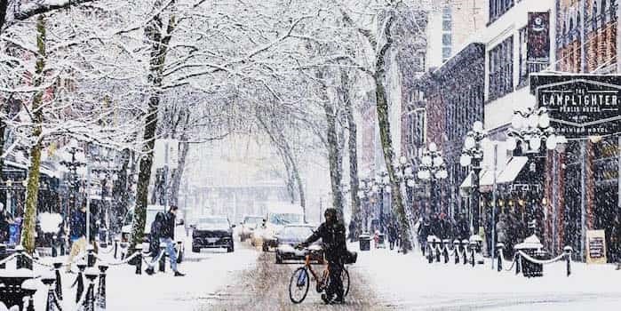
 Photo: ricarg63 / Instagram
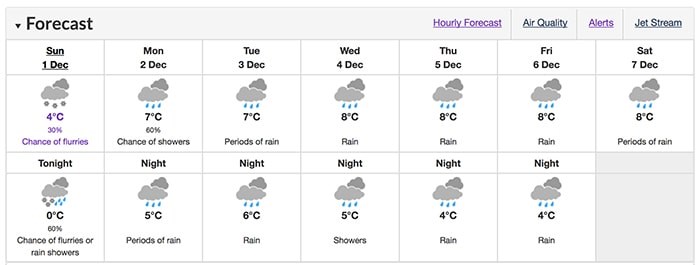
has predicted a 30 per cent chance of flurries for �鶹��ýӳ��between 2 p.m. and 7p.m. on Sunday, Dec 1.
There’s also a high likelihood it’ll snow later in the night and into the early hours of Monday morning, with a 60 per cent chance of flurries or rain showers forecast from 8 p.m. to 2 a.m.
 There’s a 30 per cent chance of flurries today. Photo: Environment Canada
It’s going to be another chilly day with temperatures sitting around 4°C for most of Sunday and dropping to a frosty 0°C at night.
Meanwhile the Fraser Valley is bracing for some wintry weather as a snowfall warning has been issued for parts of the region.
The special weather statement says between five and 10 cm of snow is expected in the area around Hope, B.C., where cool outflow winds will maintain the precipitation as snow through Monday morning.
Flurries are expected Sunday afternoon in the central and western Fraser Valley, including Chilliwack and Abbotsford. Environment Canada says that should turn to periods of snow in the evening, with between 2 and 4 cm falling. The snow is expected to turn to rain across the region Monday as warmer air arrives.
Back in Vancouver, the week ahead is going to be wet and cold with rain currently forecast for six days straight from Monday. On the plus side it will be slightly warmer during the week with daytime highs of between 7°C to 8°C and overnight lows of around 4°C to 6°C.
The City of �鶹��ýӳ��has already started opening additional shelter spaces for extremely cold weather conditions. Those in need of shelter can find updates on which locations have extra beds on the city’s .
B.C. Winter Forecast
Back in September, The Weather Network predicted that British Columbia would have a milder winter, but that December was a “wild card.”
Since then, the winter forecast has been updated to include the most recent prediction, which calls for milder temperatures along the B.C. coast and across much of Northern B.C. While northeastern B.C. to the southern interior will see near normal temperatures.
While the north coast region is, “expected to see above average rainfall and alpine snow,” the south coast region is expected to be drier than normal. With this in mind, the forecast adds that this dry pattern may break at times during the season. During these breaks, the Lower Mainland could have the, “potential to see several weeks’ worth of precipitation in just 5 to 10 days.”
— With files from Elana Shepert and the Canadian Press


