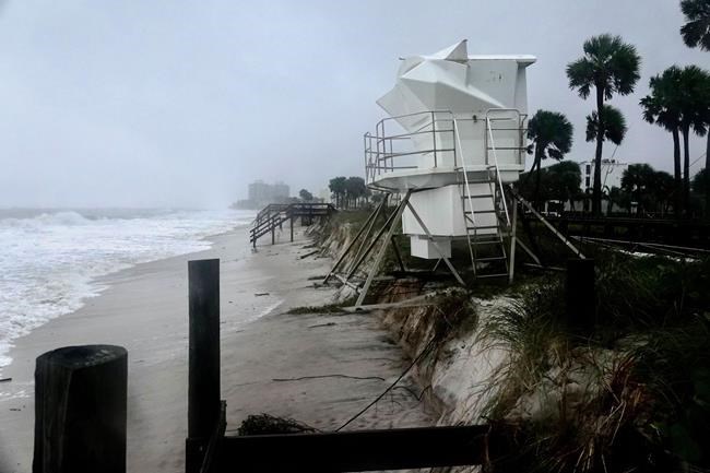
HALIFAX — The Category 1 hurricane that hit Florida early Thursday morning will feel like a typical fall storm when the weather system — named Nicole — makes its way to the East Coast this weekend, Environment Canada says.
But officials are warning about potential outages in areas of the region hit hardest in late September by post-tropical storm Fiona.
Trees that survived Fiona's hurricane-force gusts may have been weakened, Environment Canada meteorologist Bob Robichaud said in an interview Thursday. And while storm Nicole will be significantly milder than Fiona, "there's always the unknown as to what was weakened as a result of Fiona," he said, adding that damaged trees could cause outages.
Fiona came with storm surges and wind speeds of more than 175 kilometres per hour, and it destroyed about 100 homes in Newfoundland. The late-September storm caused widespread power outages across Atlantic Canada that lasted as long as 19 days in some parts of Prince Edward Island.
P.E.I. said in a statement Thursday that due to weakened trees near power lines, residents should prepare for power outages when storm Nicole hits the region on Saturday. The province is also encouraging residents to prepare for wind gusts by clearing the debris left in Fiona's wake.
Robichaud said the western region of P.E.I. is projected to see wind gusts and as much as 50 millimetres of rain. Nicole is also expected to bring significant wind in Nova Scotia and heavy wind and rain in New Brunswick Saturday.Â
Environment Canada said in its Thursday afternoon tropical storm update that Nicole is expected to track through New England early Saturday and hit the Maritimes later that evening. The strongest winds are expected in New Brunswick's Acadian Peninsula and in Quebec near the Gulf of St. Lawrence. There is also a risk of minor flooding in northeastern New Brunswick.
Because Nicole is being closely followed by a winter storm system, Newfoundland and Labrador and Quebec's CĂ´te-Nord region may see snow or freezing rain Sunday.
"This other weather system is crossing over the Great Lakes, and this second system is going to pick up whatever is left of Nicole as it moves over the mid-Atlantic states, and the two (storms) are going to combine to give those rainy and windy conditions," Robichaud said Wednesday.
Newfoundland and Labrador said in a statement Thursday that residents should prepare for large waves and storm surges along with the snow and freezing rain. The province is urging people to protect vulnerable coastline residences from “the potential of damage to infrastructure.” A provincial website is encouraging people living on the coast to prepare by having sandbags on hand or installing a sump pump, and by having a bag of essentials ready in case evacuations are necessary.
Tropical storm Nicole reached hurricane status late Wednesday night as it approached Florida and brought with it damaging surge waves and high winds that continued into Thursday.
The weather system has been downgraded to a tropical storm and is expected to track northward and inland and reach Georgia and the Carolinas Friday before merging with a cold front.Â
This report by The Canadian Press was first published Nov. 10, 2022.
---
This story was produced with the financial assistance of the Meta and Canadian Press News Fellowship.
Lyndsay Armstrong, The Canadian Press


