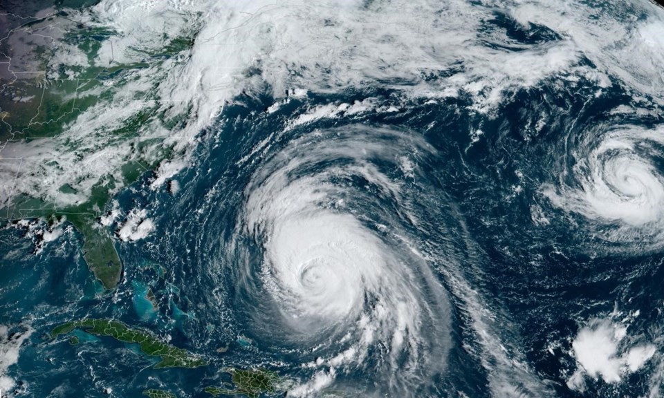
HALIFAX — Hurricane Lee is now threatening to make an earlier and windier landing in the Maritimes after picking up speed on its approach to land, forecasters say.
Chris Fogarty with the Canadian Hurricane Centre said in a Wednesday morning forecast that the storm may feature a "somewhat faster approach speed" as it passes Cape Cod and arrives in the region. That would increase the wind threat over western Nova Scotia and southern New Brunswick, Fogarty wrote.
"As of now, western Nova Scotia has the highest possibility of impacts," he wrote, adding that the region has not been hit as severely as other parts of the province during recent storms such as Dorian and Fiona.
In an updated statement Wednesday afternoon, the centre described the arrival of Lee as "a Saturday event for the strongest impacts, with lingering, weaker conditions on Sunday."
In an interview, Bob Robichaud, a meteorologist at the centre, said if the storm comes up from the mid-Atlantic more rapidly than originally expected, "the storm will not necessarily weaken as fast, and it's still within the range of wind speeds between 100 and 120 km/h by the time it reaches the Gulf of Maine area."
However, the eventual track of the storm remains uncertain, and the centre says it could make landfall anywhere from the coast of Maine to western Nova Scotia.
He said that one factor that could affect the forecast is the manner in which an area of low pressure interacts with the storm as it approaches.
As of 4 p.m. local time, the storm was in the northern Caribbean, ranked as a Category 3 hurricane and located about 675 kilometres south-southwest of Bermuda. It was moving at 25 km/h.
Lee is forecast to keep travelling north and lose strength in cooler waters before potentially making landfall in Canada as a tropical storm, and becoming a post-tropical storm.
Still, Atlantic Canadians are now well aware that a post-tropical storm — which tends to have a wider shape and less intensity than a hurricane — may nonetheless pack a powerful punch, with winds close to hurricane force and the capacity to deliver 50 to 100 millimetres of rain in a few hours, said Robichaud.
Robichaud said it's still too early to give precise predictions on the potential tidal surges along the Bay of Fundy, but he said it isn't currently expected to produce major rises in coastal sea levels. In addition, the storm is arriving during a week of lower tides in the bay.
"It's not going to be something like we saw last year with (post-tropical storm) Fiona," he added.
The hurricane centre is also calling for rainfall on Thursday and Friday across the Maritimes in the prelude to Lee's arrival, with amounts varying from 20 to 40 millimetres.
Robichaud said the storm's heaviest rain typically falls on the left side of the storm's track — which he said in Lee's case would likely be in western New Brunswick and northward into eastern Quebec.
This report by The Canadian Press was first published Sept. 13, 2023.
Michael Tutton, The Canadian Press


