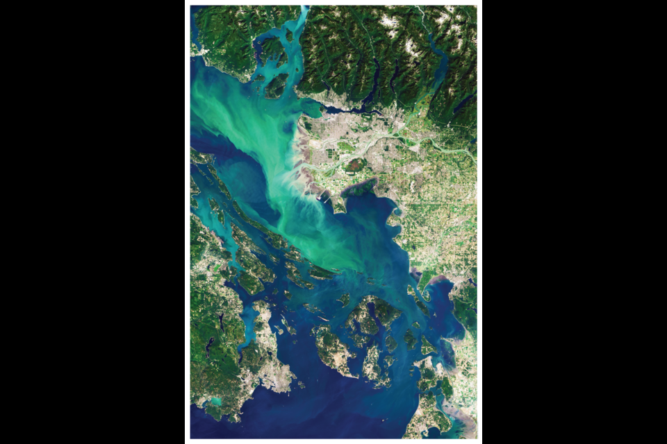
If you saw the photo of Â鶹´«Ã½Ó³»by the European Space Agency the other day and thought "Wow, I wish I could put that in up on my wall!" you can.
Point Two Design in Kitsilano specializes in using map data and satellite images in highly detailed art. CEO John Owen de Lancie and his partner founded the company in 2014 after working in architecture.
'We make data beautiful'
"When we graduated we were working in different firms," he says. "I got to work at an urban planning firm; in that role I was doing a lot of GIS (geographic information system) work. It's how everybody maps."
As he was working with the maps he began to see them as interesting designs; his background prior to architecture was in art and graphics. That's when the idea to turn the data into design came and Point Two was founded.
"The best tagline I can say is we make data beautiful," he says.
Geography as art
While they started out turning maps into art, they've moved into other fields. In particular, they contacted DigitalGlobe, an American company specializing in satellite imagery after de Lancie got into looking at images shot from the International Space Station.
"We made a deal and we basically spent a whole year using all the satellite imagery," he says.
There's a lot to go through; the satellites orbit in a sun-synchronous orbit, which means they go around the earth north-to-south and go over the same piece of land every 90 minutes or so.
"We either went through images or wait for satellites to fly over on perfectly clear day," he says.
It's time-consuming, but when it lines up it creates spectacular images.
"The macro-scale you're looking at reveals things you never see, even from an airplane," de Lancie explains, describing the algae bloom that happens off Vancouver's coast when the glacial melt comes out of the Fraser.
"Which is why you get those insane, they almost look fake,...rich vibrant turquoise greens," he says.
He calls it the "god's eye view" and likens it to the .
"Patterns we make as humans on the planet can be fascinating as well," he adds.
Turning the maps and satellite images into art is popular, he believes, because everyone has their own sense of place, and representing that the way Point Two does connects with that.
And the images they get are high resolution enough a ton of detail is captured. The files are 100 GB and have a resolution of 30 cm (so each pixel is 30 cm squared). At that level, you can make out people walking around Granville Island, though it depends on the size of the image (the full Â鶹´«Ã½Ó³»shot stretches from Point Roberts to the North Shore Mountains).
They don't just focus on Vancouver, either. They range from famous , to , to to .


