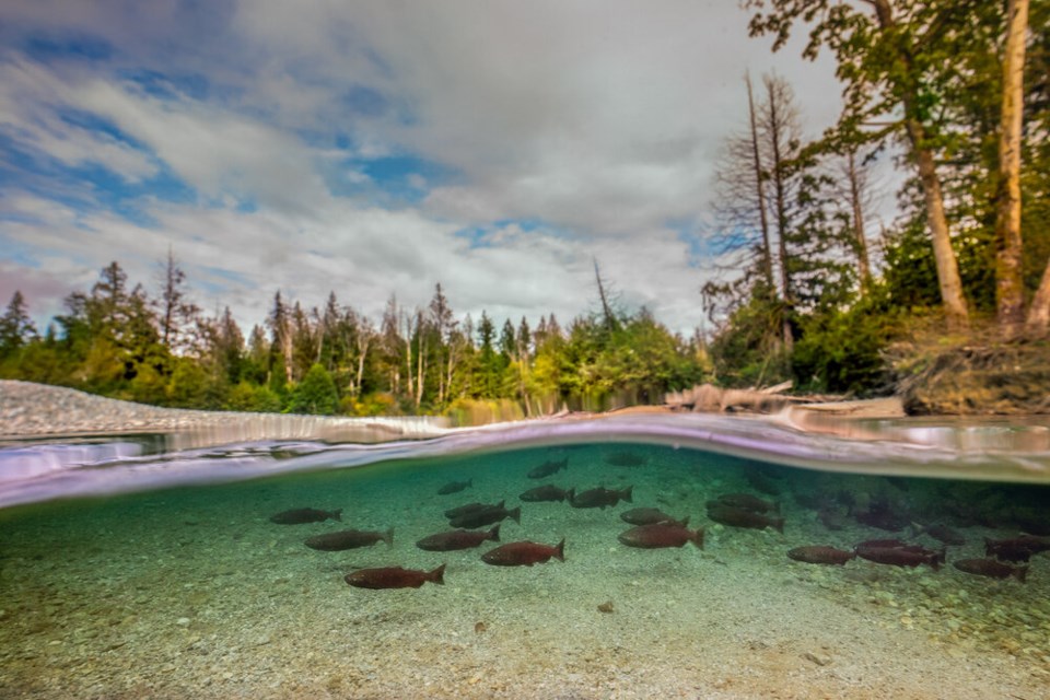
Conservation scientists are calling for the removal of 1,200 barriers in Canada’s most productive salmon-bearing river after a landmark study found historical habitat has declined by up to 85 per cent.
The study, , was published by researchers from UBC and the Raincoast Conservation Foundation last month in the journal Ecosphere.
Researchers mapped hundreds of barriers in streams and along dikes across the southern end of B.C.’s largest river. By analyzing vegetation records surveyed to give away land to settlers in the 1850s, the team was able to create digital elevation models spanning 20,203 square kilometres from Hope to Delta. From there, the team used a series of data sets to overlay a network of culverts, dams, dikes and flood gates that prevent salmon migration.
Of an estimated 659 square kilometres of historical floodplains, only 101 square kilometres remain accessible to salmon, says lead author Riley Finn.
Another roughly 1,700 kilometres have been completely lost, and Finn says urbanization or reclaiming land for agriculture (i.e. draining floodplains of water) are to blame.
"I live in Vancouver. It’s easy to forget there were lots of salmon streams in the city," says the research associate with the Conservation Decisions Lab in the faculty of forestry at UBC.
All told, 1,200 barriers prevent salmon from reaching about 2,224 kilometres of streams.
The study acts as a counterpoint to research pointing to ocean mortality as a major cause of declining salmon populations.
“The magnitude of habitat loss in the Fraser cannot be ignored and suggests it is a major driver of observed salmon declines,” write the authors.
UBC forest and conservation science professor , who runs the Conservation Decisions Lab, says salmon are facing multiple threats both at sea and in rivers like the Fraser.
“If salmon do not have sufficient habitat to breed and complete their life cycle, then none of the other conservation management actions we take will matter,” she says in a written statement.
OTTAWA'S BIG BET
In June, Fisheries and Oceans Minister Bernadette Jordan released details of a five-year , saying it would include the building of two new hatcheries, increased conservation measures, habitat enhancement and a change in the way harvesting is carried out.
A $647-million federal investment to restore wild Pacific salmon stocks signals a “transformative change,” according to Aaron Hill, head of the Watershed Watch Salmon Society, but fails to lay out recovery plans for critically endangered species, like wild , coho and sockeye salmon.
Finn says his team’s research raised similar questions.
“This loss is particularly critical for populations of coho and chinook, which rely more heavily on these habitats for rearing, compared to other types of salmon,” says the researcher.
KNOCKING DOWN BARRIERS
Part of the reason the research team set out to map such a huge span of rivers and streams was to offer a long-count perspective often missing in humanity's view of the natural world.
“These processes of habitat loss happen over time. If we shift our perspective of what that looks like, we can understand these shifting baselines,” Finn tells Glacier Media.
Without a signpost beyond a single person’s lived experience, it’s impossible to understand just how far nature has fallen. At the same time, mapping barriers for salmon migration also creates a path for restoration.
“Now, we can kind of look at it and say, 'Where can we get the most habitat back?'” says Finn.
Resilient Waters is working with a number of field crews and volunteers to collect regional data on fish population, water quality and potential for restoration across the Lower Fraser Basin. That work is expected to wrap up in the fall.
Some of its highest priority projects include restoring habitat at Tillbury Slough in Delta, Maple Creek in Port Coquitlam and Backwash Slough near Chilliwack.
Meanwhile, Resilient Waters began work on a fish-friendly flood gate to improve water flow and fish passage through 7.5 kilometres of salmon habitat along the Agassiz Slough. Nearby, work has begun to replace an aging floodbox that drains eight kilometres of land, including most of the stormwater from the town of Agassiz. The 1970s piece of infrastructure included a culvert with a hinged flap gate that blocked migrating fish.
With money from Emergency Management BC and the province’s BC Salmon Restoration and Innovation Fund, the high-priority project is meant to both help fish and prevent flooding.
“There’s lots of good work going on to start removing these barriers,” says Finn.
In other cases, existing culverts are too small to handle huge flows of water. The water pressure erodes the downstream ends of the culverts, leaving them overhung and inaccessible to fish.
Sometimes, the solution means knocking down dikes, a tricky proposition in a province where many communities face growing risk due to climate-induced flooding.
“Historically, there wasn’t really a discussion of balance. Having that now, when we need to update this infrastructure for climate change, is a good thing,” says Finn.
“I hope this sparks that discussion: What are our ambitions?”
Correction: An earlier version of this story identified one of the organizations behind this research as the Rainforest Conservation Foundation. Its name, in fact, is the Raincoast Conservation Foundation.


