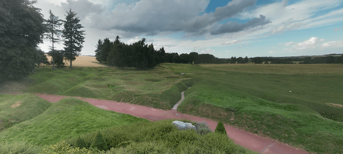
 Photo: Google Street View
Canadians can travel over a hundred years back in time this Remembrance Day and explore historical spots and major battlegrounds of World War I online.
Using Google Street View, locals can view The Battle of Vimy Ridge, a defining moment for the Canadian forces in WW1. They can follow the and see how the battle affected the area with trenches and shell craters that are still visible today.
Google mapped Vimy Ridge on foot in 2016 and 2017, and now viewers can have a first-person perspective of the trenches, tunnels, and the overlooking the battlefield. In, the pock-marked battlefield is still visible today.
Go in the trenches
The National Library of Scotland has also released 307 interactive trench maps, which allow users to navigate trench maps/enemy positions side-by-side with Google Maps satellite imagery. For example, you can observe the in 1916 where the and is still visible at Newfoundland Memorial Park (which commemorates The Newfoundland Regiment's role in the Somme). What's more, in the trench lines still remain visible.
A huge hole in the ground created by a mine blown under the German Front Line on the Somme battlefield on 1st July 1916 - called Lochnagar Crater - can be viewed in and . If you visit this area today in Street View, you can see several Commonwealth .
In street view, you can also see WWI trenches, including one of the war's first large scale battles in .
Watch Prime Minister Mackenzie King inspecting the Canada War Memorial in 1928 before it was installed in Ottawa:


