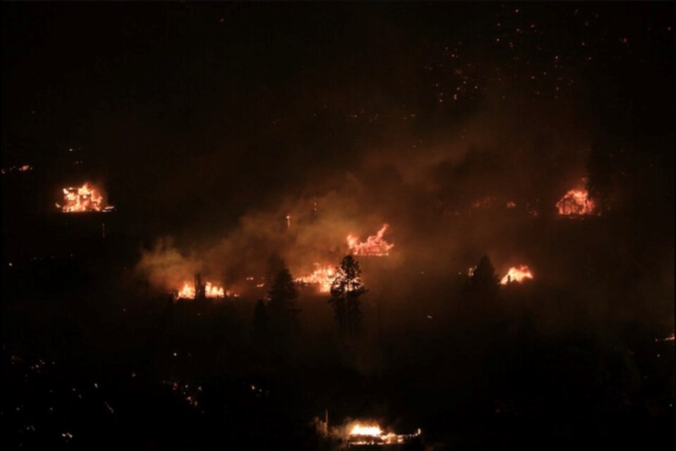
At least 50 structures have been lost or damaged to the McDougall Creek wildfire within the City of West Kelowna and Westbank First Nation.
West Kelowna fire chief Jason Brolund says there have been no structural losses in the Shannon Lake, Talus Ridge, Smith Creek, Rose Valley neighbourhoods as well as the Lenz Road modular home park.
The 50 structure estimate came with a caveat from Brolund that “we're not done yet. And the most damaged neighbourhoods are still to come. “
“However, I think it's important that people begin to understand the scope and scale of what our community is facing.”
Brolund said the numbers of structural losses will certainly climb beyond 50, noting damaged assessments have only taken place in the “easy” neighbourhoods.
“But we're moving into the areas where the fire burned hottest. I describe it as a hurricane, trees pushed over by their roots. This is the kind of neighbourhood that we're in today. So undoubtedly, that number will grow higher.”
He noted that the hardest hit neighbourhoods are also the most rural. Homes are further apart and some properties have multiple homes on them.
“So we're having to actually be boots on the ground searching through the properties to get the counts,” he said.
has been helping with damage assessments in West Kelowna and on WFN lands and has not made their way into the Westside Road area of the rural district.
As a result, North Westside fire chief Ross Kotscherofski could not provide a number of damaged or lost structures in his area, but said structural loss has been sustained along Westside Road “all the way up” to the , which was also destroyed.
He said the Traders Cove neighbourhood was the hardest hit. There has been no structural loss north of the resort.
Brolund says they are working as quickly as possible to get information out to property owners and lifting evacuation orders.
“I know people want to know information, and I know they want to go home,” he said.
“We are going to take a systematic approach to both of those. We're going to do it right. We're going to make sure that to the best of our ability we don't make mistakes, we don't tell someone something that isn't true. We don't send you into a place that's not safe for you to be.”
Brolund did not provide an estimate as to when evacuation orders and alerts may be lifted, but suggested there is a lot of work still to do to make some neighbourhoods safe.
Downed power lines need to be repaired, roads may not be passable.
“In many cases right now, your neighbourhoods and houses are covered with sprinklers and those sprinklers are protecting your home, but it means we can't send you home because the streets have fire hoses, fire pumps, water bladders scattered throughout the area.”
Jerrord Schoeder of the BC Wildfire Service says the McDougall Creek wildfire, like the other two fires burning in the Central Okanagan, remain classified as out of control, but “excellent” progress has been made over the past 24 hours.
“We're not expecting any rapid increases in fire behaviour or spread on any of these fires today… while we are still working into the context of extreme drought conditions and our fire weather values are in the extreme levels,” Schoeder said.
He said crews continue to focus on structural protection and the interface areas.
It is hoped that the smoke hanging in the valley may lift this afternoon enough to allow firefighting aircraft to get up and into the sky.
Brolund noted that the thick smoke is one of the biggest challenges facing crews on the front lines right now. “It is choking.”
“The firefighters are outside working in it relentlessly. They're breathing it for 12-14-16 hours at a time. So it's a real challenge.”


