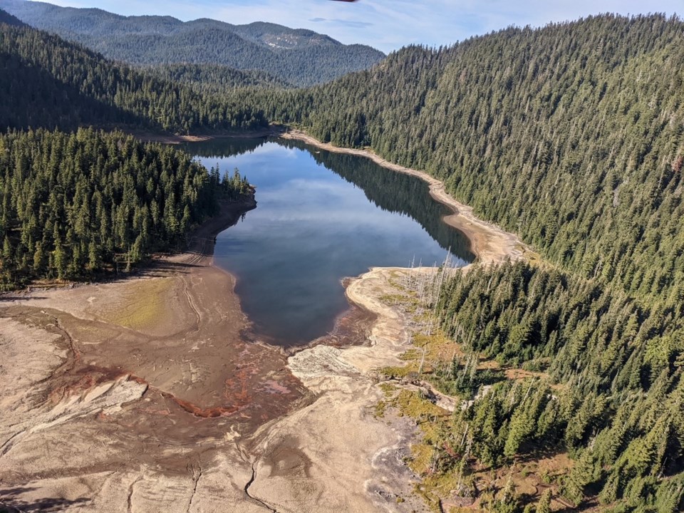
This story is the fifth in a multi-part series running throughout June exploring the wide-ranging impacts of persistent drought conditions and climate change seen across the province in recent years.
The B.C. government this spring is at 63 percent of its normal level, the lowest in 50 years, creating a significantly higher drought risk for this spring and summer.
But, what exactly is a drought?
According to the , updated this past April, there are three major factors used to determine a drought: low winter snow accumulation, spring weather and the rate of snow melt, and warm summer weather with little precipitation during July and August.
For significant drought to occur, two of the three factors often need to occur.
For severe drought (as in 1929, 1931, 1955, 2003, 2009 and 2015), all three factors often need to occur, in addition to sequential years of reduced precipitation. As a result, multiple indicators usually need to be considered to determine if a drought will take place or is likely to occur.
But measuring drought is a complex process, particularly in a place like B.C. with its geographic diversity and regional microclimates. The plan notes, most indicators also require comparison to other droughts, which demands access to detailed historical climate data.
Drought can lead to reduced water availability for household and business use and also impact Indigenous communities’ access to traditional foods and medicines.
Drought impacts on fish and fish habitat
Drought and aquatic ecosystems by causing:
- Fish streams with little or no water
- Low stream flows
- High stream temperatures
Drought conditions can also lead to:
- Fish strandings
- Death of fish
- Delayed movement of migrating fish into spawning streams
- Losses in biodiversity
The province is working with Fisheries and Oceans Canada, First Nations, non-governmental organizations, and others to develop and share information and educational materials. These groups are taking action to support priority fish populations affected by drought, which includes relocating stranded salmon in dry or low streams, providing or improving fish passage in low-flow streams, creating cold water refuge habitats and implementing and enforcing fisheries closures to protect at-risk stocks.
Socioeconomic effects
The response plan states Level 4 or 5 conditions are almost certain to cause adverse socioeconomic effects. In 2023, more than 80 per cent of B.C.’s water basins reached those levels with the lower Sunshine Coast assessed at Level 5 conditions by mid-August.
On the Sunshine Coast, the impact has most keenly been felt in water restrictions.
Aiden Buckley, manager of communications and engagement with the Sunshine Coast Regional District (SCRD), says for the past three years in a row, the lower Sunshine Coast hit at least , which mandates the most severe water conservation regulations.
“Essentially, it's a complete ban on outdoor water,” says Buckley. “So, if you don't have your own water source, like a rain barrel or something along those lines, you essentially can't water your garden or use water for that kind of thing.”
Oct. 17, 2022, in the Sunshine Coast Regional District (SCRD), District of Sechelt and shíshálh Nation lands, due to ongoing drought and associated risk to the Chapman water supply.
The Chapman Creek Watershed supplies drinking water to the majority of residents of the Sunshine Coast living in areas from Secret Cove to West Howe Sound. Those users had been on Stage 4 water restrictions since Aug. 31, 2022.
The state of emergency meant by breweries, cideries and distilleries, water bottling businesses and non-medical cannabis producers. Also banned was use involved in the transport, processing, cleaning, installation or repair of concrete, cement, asphalt, gravel or aggregate.
Buckley says in light of recent drought conditions, the SCRD has been working hard on diversifying its water sources.
“Chapman Lake is a rain and snowpack dependent system, so we have a well system now that’s available on Church Road, which just came online last year and will be able to provide up to 4.6 million litres of water a day,” says Buckley.
Climate change
Erik Porse, director of the and an Associate Cooperative Extension Specialist in the University of California Division of Agriculture and Natural Resources, told the Coast Reporter, there are ways to define drought that are based on climate factors.
“When temperatures are hotter and drier, a drought is more severe,” he says. “Over longer periods, like two years, three years, four years, those other climate factors are defined.”
Simply put, when temperatures rise, precipitation lowers.
Porse notes, as is the case with B.C., California water management is designed around a water/snowpack capture system dependent on winter precipitation levels.
“It’s designed to be able to capture enough water that you're providing multiple years worth of potential water supply for agriculture, cities, environmental systems, and, depending on where you are, they might be connected to a larger interconnected system that has statewide reach for our regional system,” says Porse. “And so, each year we’ve ended up having a worse drought when we don’t have any precipitation for about five months or so. So, we use all the water we captured and the snowpack through sustained water usage over time. It also correlates with the growing season and when we use a lot of water.”
Porse notes human expectations for water have gone up over the years.
“So, we have more fields that need irrigating, we have larger cities that have more water demand,” he says.
Looking to the future, Porse says there are huge aspects of climate variability, which will have extreme effects on agriculture and the way food production is ensured, B.C. included.
“Those systems will be increasingly constrained and what we grow here in California is going to change and it's going to have an effect going all the way up and down the West Coast.”


