While hiking recently in Lighthouse Park, a gentleman approached me from the opposite direction on the trail to the Valley of the Giants. After a friendly hello, he looked up to the forest and said one word. тАЬMagical.тАЭ
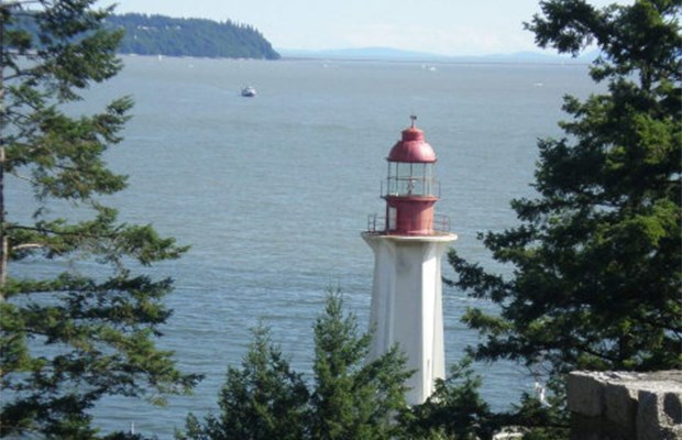
Most Vancouverites have been to West VancouverтАЩs Lighthouse Park at some point in their lives тАФ usually just to see the historic lighthouse, which dates back to 1874.
Hiking here involves only moderate effort, and the hardest part could be avoiding tripping over rocks and roots on the trails while looking up to admire huge, old growth trees including some of the largest fir and cedar trees in Vancouver.
You can thank that lighthouse for all the massive trees. Sixty-five hectares of forest was protected by the Dominion of Canada in 1881 to provide a dark backdrop for the lighthouse. The current building was constructed in 1912, and the trees remained off-limits to loggers clear-cutting the North Shore.
To reach Lighthouse Park by car, take Marine Drive west to Beacon Lane (just after the fire hall) and turn left. The #250 bus from downtown ┬щ╢╣┤л├╜╙│╗нalso stops at Beacon Lane. Arrive early, especially on weekends, and allow yourself plenty of time (three hours minimum, but ideally four hours) to truly explore everything there is to see in the park. There are nearly 20 different trails and close to a dozen fantastic viewpoints along the way.
Grab the excellent park map at one of the information boards in the parking lot or use the one provided here. Most tourists and sightseers walk directly south to the lighthouse area. But our suggested route winds through the forest and across the path of nearly one hundred giant trees, makes stops at rocky ocean viewpoints, and stops for an obligatory look at the lighthouse.
Start on the upper branch of the Juniper Loop, heading towards Juniper Point and its perfect view of Bowen Island. Returning along the lower trail provides some hints of the massive trees to come. Turn right at a large cedar with a тАЬhanging root,тАЭ which marks a junction with the Shore Pine Trail. The centuries-old cedar originally grew out of a decaying nurse log, a fallen tree that provided nutrients for the current tree.
Heading south, Shore Pine Point is another great stop for a snack or drink while enjoying the coastal views. The trail continues south and east, passing more big trees and rocky viewpoints before reaching the parkтАЩs namesake. The lighthouse is officially recognized as a national historic site, but sadly has suffered from recent neglect after the federal government deemed it surplus and put the building up for sale.
After taking your photos of the lighthouse, check out two nearby buildings used to house soldiers during the Second World War. The old dining hall now serves as Phyl Munday Nature House and is operated by the Girl Guides. It is named after Phyllis Munday, one of B.C.тАЩs greatest early mountaineers.
Head north, back into the forest and turn left to reach the Seven Sisters Trail, named after a cluster of large firs and cedars guarding the trail near the junction with the Lady Fern Path. Turn right here, and after a quick uphill trek, you reach a massive Douglas fir, close to 2.5metresin diameter and 65 metres tall.
Our suggested route now heads to my personal favourite section, the serene Valley Trail which features some of the biggest western red cedar trees in the park, along with massive yellow cedars and giant Douglas firs. Some are estimated to be over 600 years old.
After exploring the entire Valley Trail and Starboat Cove, retrace your steps north, then turn right at the Arbutus Trail for a short, steep uphill climb. A close look at one severely curved tree trunk hints that it also possibly grew out of a nurse log that has long since decayed into the forest floor.
The next junction arrives just steps after the trail splits at two giant Douglas firs. Turn right for a quick trip to Eagle Point; some of the rocky points and coves are ideal for finding a secluded picnic spot and swimming hole with views looking south to Pacific Spirit Park and the UBC campus and east to Stanley Park and downtown Vancouver.
Or, turn left for your uphill venture into the Valley of the Giants. A close look at some of the old-growth firs shows how thick the gnarly bark can be on these trees тАФ some have grooves close to 20 centimetres deep.
Just before the next major intersection is a knotted Douglas fir on your left that has undergone some twisted early growing years, yet still lives and reaches to the sky. If youтАЩre really short of time, turn left and take the uphill Summit Trail back to the parking lot.
If not, continue north onto to the Maple Trail to head towards the parkтАЩs boundary where you will be rewarded with yet another cluster of huge trees named the Grove of Four. One of the Douglas firs in the group is the tallest tree in the park and one of the tallest of that species in all of B.C. It tops out at nearly 80 metres.┬а
From here, follow the well-marked trails back to the parking lot. But if youтАЩd like one last climb for some exercise and a different view of the park, follow the signs to the тАЬsummit,тАЭ which is actually just a rocky outcrop barely rising above the forest at the parkтАЩs highest point at 117 metres.
Mike Hanafin is an avid backcountry hiker who can see the forest and the trees. Tell him about your favourite hikes at [email protected].


